閉じる
閉じる
山の日レポート
通信員レポート
【空撮動画】十勝岳
2024.06.27
北海道も夏山シーズンに入り、十勝岳の撮影をしてきました。息づく火山の雰囲気をご覧ください。
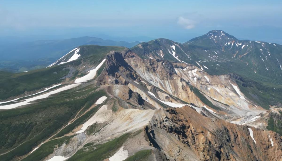
十勝岳(標高2,077m)は北海道の中央部の上川郡新得町と美瑛町、空知郡上富良野町に三町にまたがるり、大雪山国立公園の西南部に位置する十勝連峰の主峰で、今なお噴煙を上げるコニーデ型の活火山です。過去に何度も爆発し、噴火のたびに地形が変化しています。、火山礫に覆われた山頂部は草木も生えない荒涼とした世界だが、360度の視界が開け、十勝連峰や表大雪の山々、富良野盆地越しに見える芦別岳など、北海道の地形が実感できる景観を楽しめます。日本百名山の他、花の百名山にも選定されています。
Mt. Tokachi (2,077m above sea level) is the main peak of the Tokachi mountain range, located in the southwestern part of Daisetsuzan National Park, and straddles three towns in central Hokkaido: Shintoku and Biei in Kamikawa District, and Kamifurano in Sorachi District. It is a cone-shaped active volcano that still emits smoke. It has erupted many times in the past, and the topography changes with each eruption. The summit, covered with volcanic gravel, is a desolate world without any vegetation, but the view is 360 degrees wide, and you can enjoy the scenery that allows you to experience the topography of Hokkaido, such as the Tokachi mountain range, the Omote Daisetsu mountains, and Mt. Ashibetsu seen over the Furano Basin. In addition to being one of the 100 famous mountains in Japan, it has also been selected as one of the 100 famous flowers.
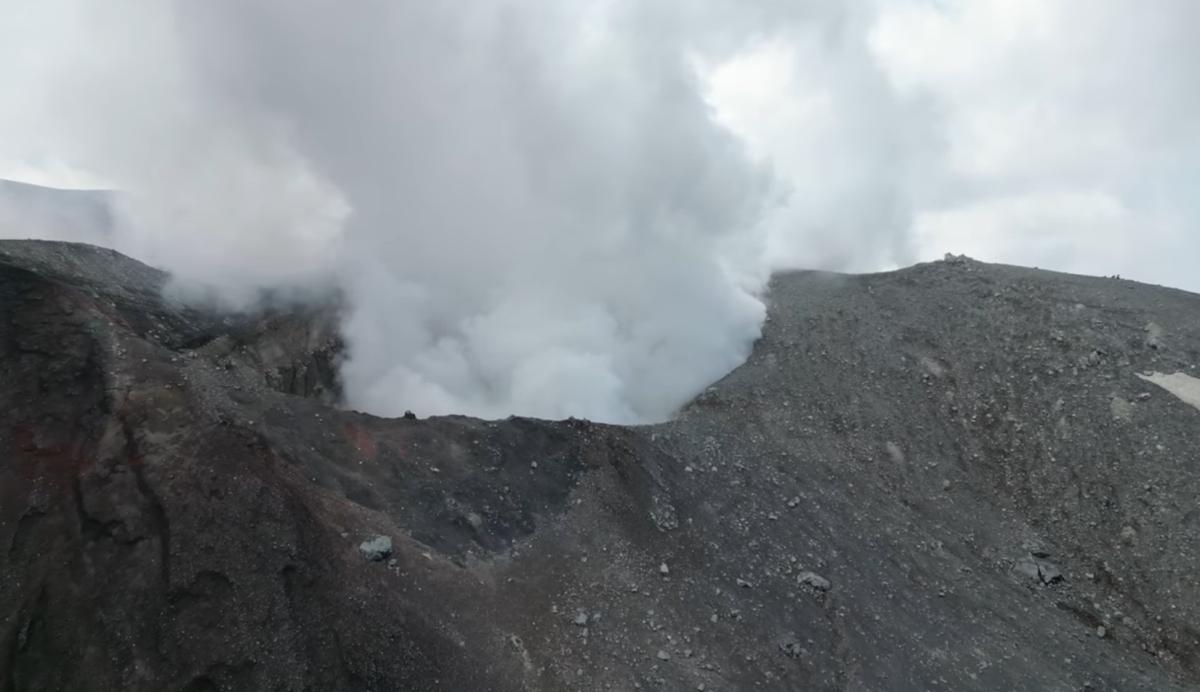
噴煙を上げる十勝岳 撮影:田島琢さん
十勝岳 撮影:田島琢さん
RELATED
関連記事など


